To be brief, NGA has changed the way they serve data again. While inconvenient, this just might be a good thing.
When I first started working with their data, I think you could get it in XML, JSON, and maybe something else. I don’t remember which one I used, but it was a nightmare because there was a shift in the data columns, making it nearly unusable and requiring a lot of manual labor. Later, they switched to .csv and I was, frankly, pretty happy. Now, they’ve moved to shapefiles and whatever database ESRI uses. Both are proprietary.
Overall, I don’t think it will be a huge deal as pyshp exists and can parse the formats. But, it’s a bit of work. I’m hoping that they’re also including the shapefiles for the various NAVAREAS and subregions, as NGA is one of the groups that keep records of this.
NAVAREAS look like this in case you’re wondering:
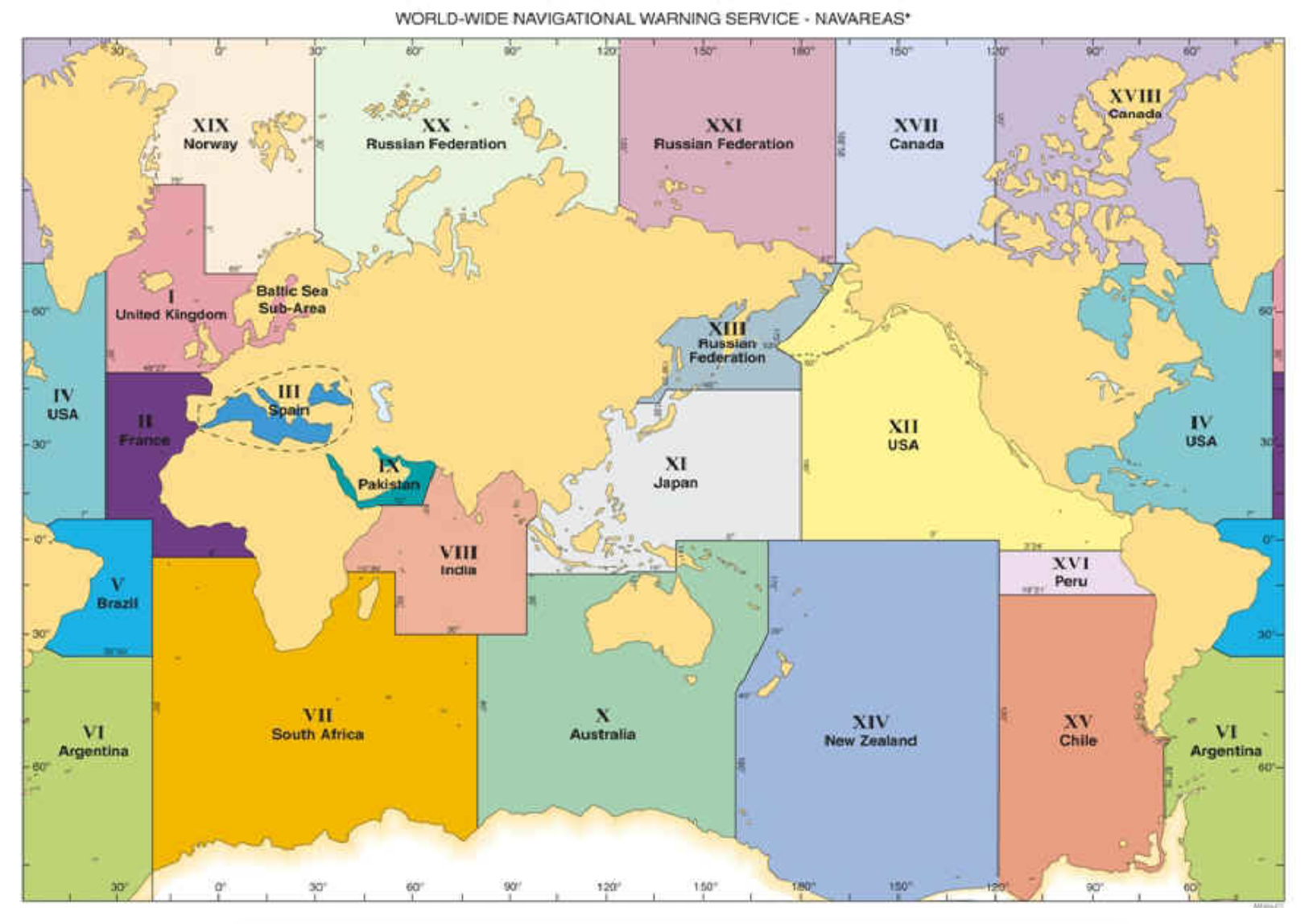
Now, you might think that it would be pretty easy to get a shapefile of NAVAREAS and subregions. After all, you can get shapefiles of the major and minor fault lines on the planet, and some of those are under hundreds or more meters of water. And the lines are pretty straight except for coasts. But, you would be wrong. As I was.
I spoke with Global Maritime Traffic to see if they had one as part of their GMTDS. They said they didn’t have one “though we have started to make progress in this regard, in coordination with IHO partners”. I have say I find this strange because because NAVAREAS were founded in in 1977 or 1991 (I’ve seen both) that they could have this done in the last few decades. But checking with either the people or the sites of GMTDS, International Hydrographic Organization, and the International Hydrographic Organization makes me think they’re either just ineffective and just stiring papers on a desk and planning to have a meeting to plan more planning meetings, they don’t know if they have such a thing, they do but want to sell it but are shy, or – and I think this more likely – it has to do with feears about potiential disputes for some coastal boundaies and not wanting to take a stand.
Anyway, I’m hoping the dataset now includes shapefiles of the NavAreas and subregions and this can be put to rest. And the specific reason for that is some of the
https://cgaviationhistory.org/1946-post-world-war-ii-coast-guard-search-and-rescue/ https://safety4sea.com/ https://safety4sea.com/uscg-overview-of-gmdss-worldwide-navigational-warnings-service/ https://en.wikipedia.org/wiki/NAVAREA